
When the chance came to travel to Turkey’s most southeastern tip and climb a mountain that, until recently, was closed off due to terrorism, I didn’t think twice. I had only been mountaineering for a year. I had never gone above 3,300 meters. But something in me knew this would be a once in a lifetime experience. And it was — in every possible way.
From gasping for air above 4,000 meters to plunging into waterfalls fed by ice from the Ice Age, from stepping into villages I never imagined I’d visit to dancing at the wedding of complete strangers — and being welcomed like family — these four days in Hakkari, Yüksekova became much more than just a climb.
This post is both a personal reflection and a summit expedition report. I want it to speak to fellow adventurers who are curious about the route, the gear, the terrain — and to anyone simply intrigued by the raw beauty and cultural depth of a region few get to see.
Climb Overview
Region: Yüksekova, Hakkari
Dates: 24–27 July 2025
Altitude: 4,135 meters
Route: Classic Route — Serpel Plateau→ Horgedim Plateau→ Summit
Group: 12 climbers + 1 expedition leader
Technical Equipment:
- Helmet
- Headlamp
- Trekking poles
- Harness,
- Belay device (ATC)
- HMS carabiner
- Accessory cord
- 1 dynamic rope (60 meters)
- 1 sling
- Protection gear (pitons, nuts)
- Hammer
Camping Equipment:
- Waterproof mountaineering boots with ankle support
- Gaiters
- Technical jacket
- Buff
- Sunglasses
- Sunscreen
- Spare clothes
- Base layers
- Fleece
- Lightweight gloves (optional)
- Medications
- Spare batteries
- Powerbank
- Extras that (would have) saved me:
- Mosquito repellent (essential — the camp was full of them)
- Lip balm and moisturizer (the heat and altitude dry your skin fast)
- A painkiller like Parol for headaches.
Wikiloc Routes:


Day 1: Arrival in Hakkari and the Ascent to Main Camp
We took off from Istanbul at 08:10 with a group of 13, heading to Hakkari’s Selahaddin Eyyübi Airport — named after the legendary Muslim leader known for reclaiming Jerusalem during the Crusades, and a lasting symbol of unity and resistance in this region.
We landed at 10:20, about ten minutes behind schedule, after the pilot had to abort the first landing attempt and circle back. Later I learned that this airport is one of the few in Turkey where pilots need special training — the runway sits in a valley surrounded by steep mountains, and landing requires a careful descent through the gaps.
Once you finally touch down, you’re struck by what surrounds you: nothing. Just open skies, dry plains, and mountains towering in the distance.

Upon arriving we stepped out into the infamous 33°C dry heat — and even the short 50-meter walk from the plane to the baggage claim had us questioning our exhibition plan. After collecting our bags and gear, we piled into a 20–25-year-old minivan with no AC and headed toward the town center.
We had landed in Yüksekova, a quiet town about 1.5 hours from Hakkari’s main city center. There’s not much going on, but we made the most of it. Our first stop was Çorbacım — a solid local spot to load up on soup and lahmacun before the hike. Then we swung by a nearby Migros to grab snacks and water for the mountain. Around 12:00, we hopped back into the van and started the drive toward Serpel Plateau where our hike would begin.
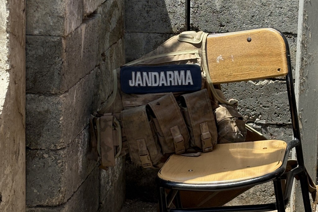
About 30 minutes into our drive, we were stopped at the Kamışlı military checkpoint for a routine security control — a clear reminder of where we were and what this region had endured over the past 20–30 years. The mountains had only been declared safe in the last 2 to 2.5 years, but the area was still under tight military oversight. Our IDs and criminal records were checked, and each of us had to sign a document agreeing to certain military-imposed rules before we could continue.
With that paperwork out of the way, we got back on the road — more or less on schedule.
But of course, nothing memorable ever goes exactly according to plan. Halfway through our drive, the minivan’s water hose broke and the engine overheated. So there we were, stranded in the middle of nowhere, trying to figure out how to get it running again. Luckily, the mountains were generous — fresh streams were everywhere. We filled up a bunch of 1.5L plastic bottles, poured them over the engine to cool it down, and eventually got the van moving again.
Lesson learned: never trust a 20-year-old minivan with no AC and a half-broken engine for a mountain expedition. Get yourself something newer — or at least something with a working radiator.

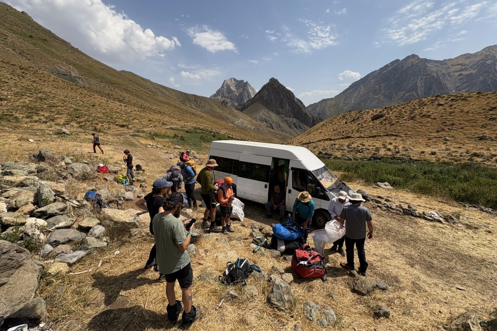
After a wonderful scenic drive to 2,100 meters we arrived at Serpel Plateau around 14:00. The landscape was absolutely incredible. Wherever you looked you saw a mountain, taller than the next one and the idea of climbing the tallest one seemed scarier than ever – especially at 35 degrees. Nevertheless, we hopped out of our minivan and started preparing our hiking bags. Our large camp bags were going to be loaded up to mules and carried to our camp site, so we gathered only the stuff needed for our 4 hour hike – water, some snacks, our hiking gear and some spare clothes to change into. At the end of July you can find fresh water in the area, so we filled our water bottles until it was full and got moving at 14:30.
We followed a fantastic route right by a water stream for 30 minutes where we occasionally used to wet our overheated heads. The route goes slightly upwards but nothing challenging. The views and the sounds and the freshness of the stream makes it really enjoyable.

After half an hour, we crossed a little bridge on top of the stream to reach the foothills of our desired mountain. We were still around 2,000 meters away from the summit but all the surrounding hills and little peaks made a great cover from the sun and made our hike easier.
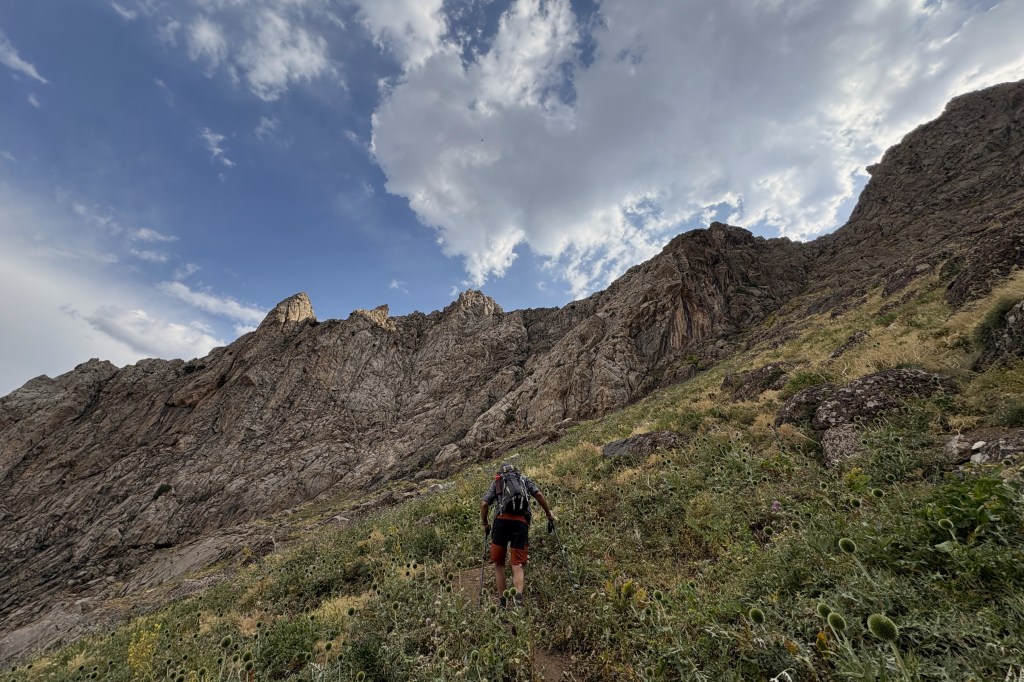
We started ascending through a mountain pass nestled between two towering peaks. It wasn’t a particularly challenging climb — though if we had been carrying the heavy packs we’d left for the mules, it probably would’ve felt a lot tougher. With just our hiking bags, the hike was fairly comfortable. The trail was a mix of dirt, rock, and a bit of scree, and we followed it up steadily. It was well-defined the whole way through, so we had no issues navigating it.
As we climbed, we passed by some incredible plants and wild nature — vibrant, unfamiliar, and perfectly blended into the mountains surrounding them. I honestly have no clue what most of them were called, so you’ll have to head out there and discover them for yourself. But then again, isn’t that the whole point?
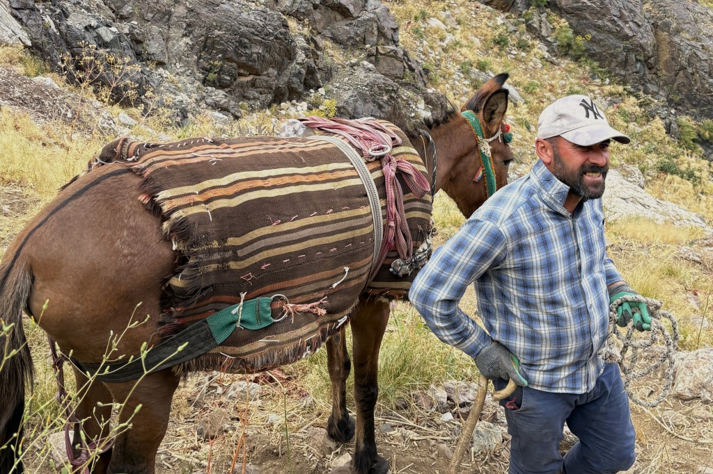
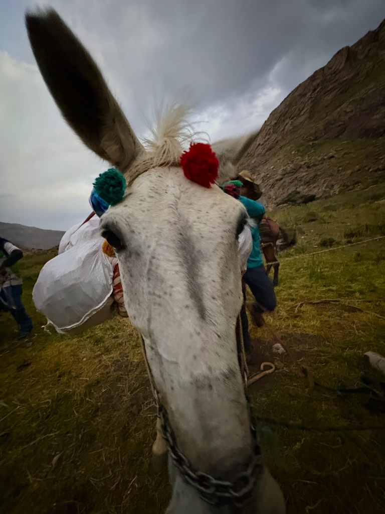
Somewhere along the way, we also crossed paths with the mules heading down the mountain to pick up our large camping bags. They usually do this twice a day and don’t even seem phased. Their ability to navigate such steep and unstable terrain is genuinely impressive — and their shepherd, hiking up and down the mountain multiple times a day, deserves no less credit.
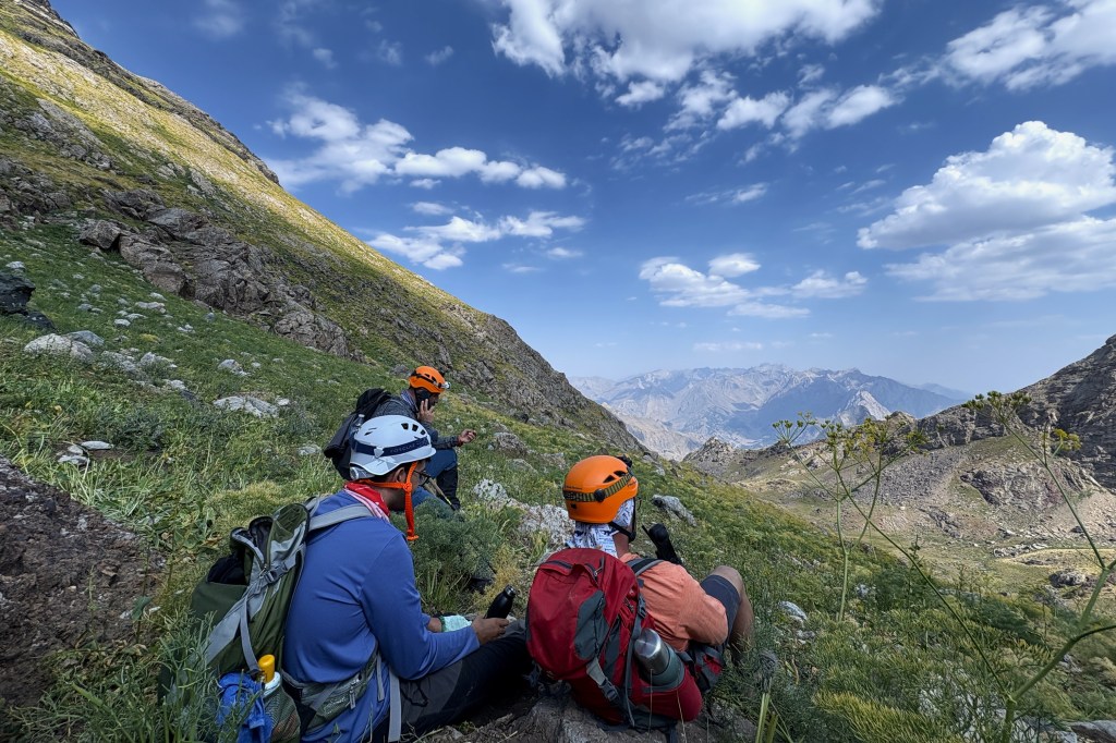
After a 4-hour, 5 km hike with 940 meters of elevation gain, we arrived at Horgedim Plateau at 18:40. This would be our campsite for the night, sitting at 2,900 meters. A freshwater source sits just beside the camp, so we took a moment to freshen up and waited for the mules and our gear to arrive.
But the flies and mosquitoes made that wait a living hell.
None of us were prepared. At any given moment, there were 10–15 of them buzzing around your face, pushing you to the edge of madness. I’m guessing it was a mix of the mild temperatures, the still air, and the abundance of mule shit in the area — whatever the reason, it was relentless. With no repellant and no long-sleeved gear, the only thing we could do was cover up as best we could and wait for our tents. So please, learn from our mistake: bring mosquito repellant, wear long sleeves, and cover up as soon as you get there.
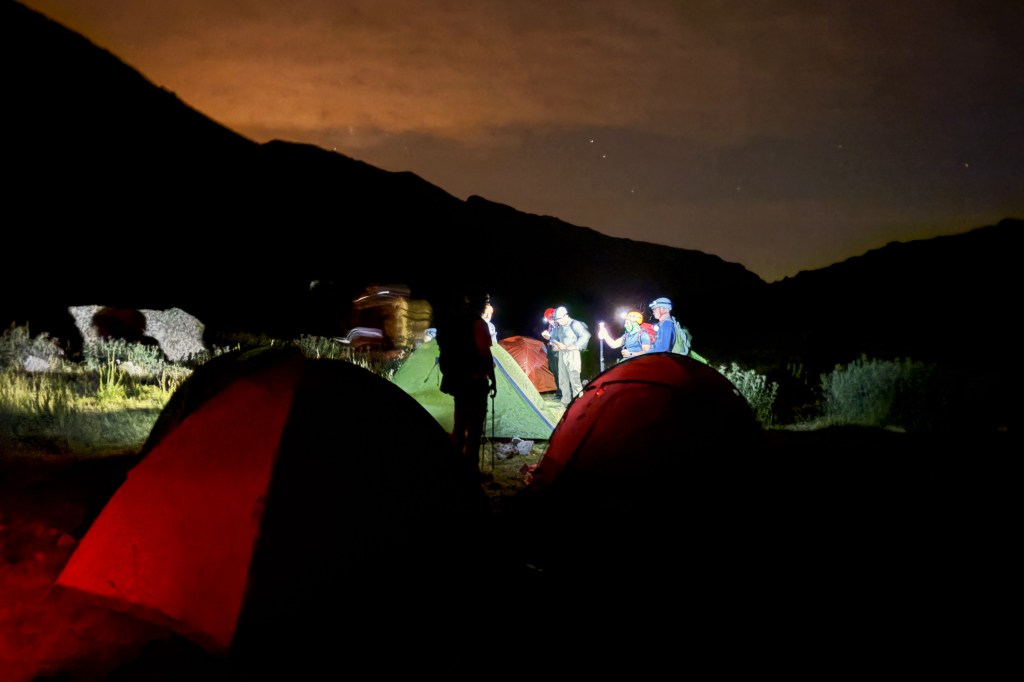
Around 19:10, the mules returned with our camp equipment. We had a lovely moment petting them (during which I captured the National Geographicesque photo below), then grabbed our gear and quickly set up our tents.
We had zero intention of spending more time outside than necessary — but we needed food in our bellies before the big summit attempt the next morning. So we started cooking. By that time, it had gotten dark, so we had to wear our headlamps — which, of course, is the single best thing you can do if your goal is to attract every flying insect within a 1 km radius.
Safe to say, it was the worst cooking experience of my life.
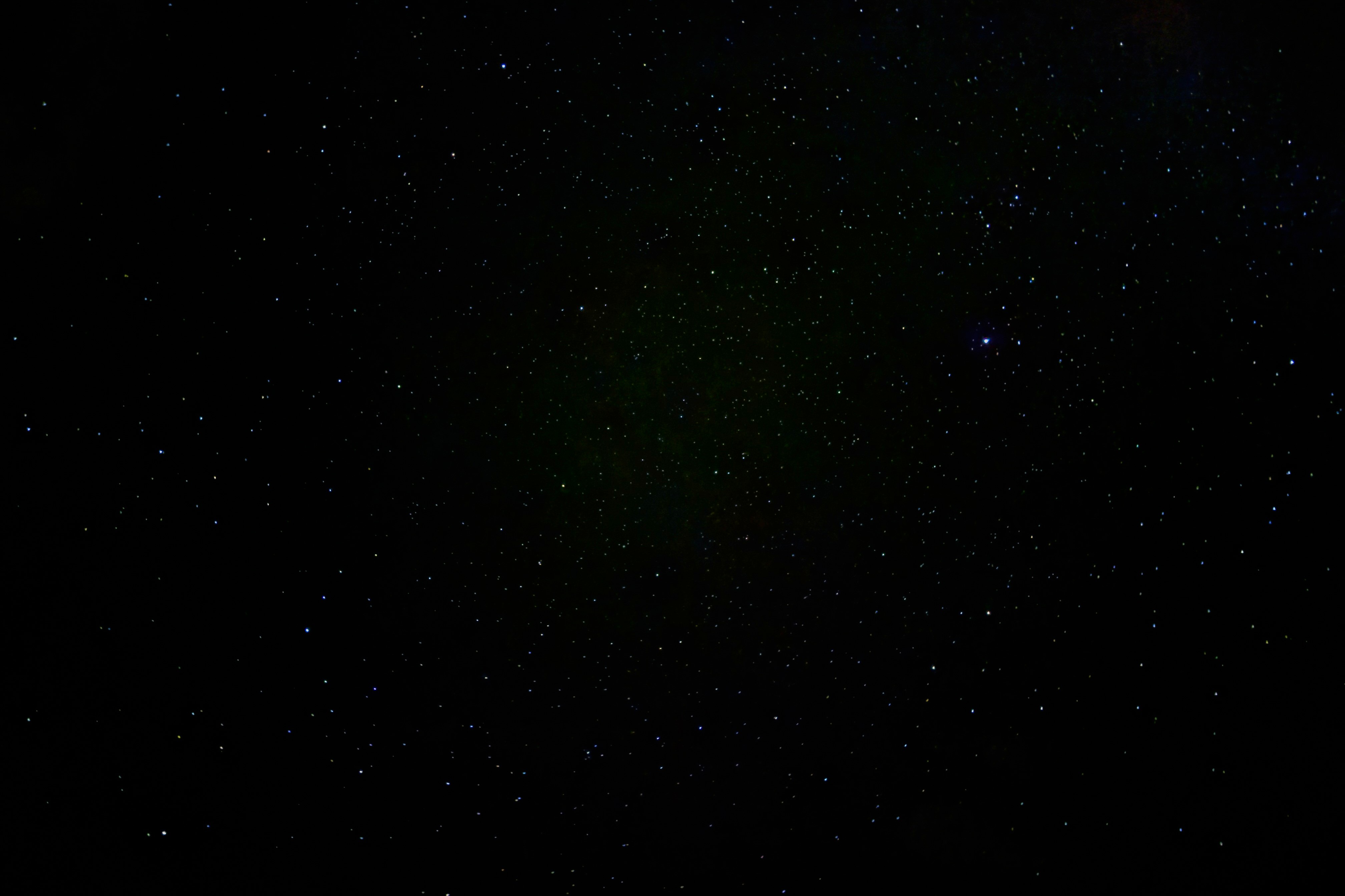
I pulled at least three flies out of the pot, nearly burnt myself while dodging others, and finished the whole thing in survival mode. Once I was done, I turned off my headlamp and ate in complete darkness — which, surprisingly, was quite peaceful. Just me, my meal, and a sky overflowing with stars.
After I ate, I laid down and stared at the sky — a sea of infinite stars and the occasional comet shooting across the horizon. I took one photo, which somehow turned out better than I imagined, and then headed into my tent around 21:30, hoping for a mosquito-less sleep before our 03:00 summit push the next morning.
Day 2: A 13-Hour Trek to Reşko’s 4,000+ Meter Summit
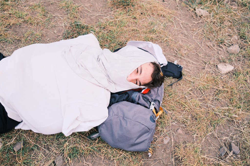
We woke up around 02:30 — a little tired from the day before, and a little sweaty from the night. It turned out to be warmer than we expected, hovering above 20°C, so our sleeping bags were pretty much useless. We got dressed, packed our gear, and stepped out for the summit push at 03:20. There was another group that had left earlier at 02:00, and to avoid overlapping on narrow sections of the trail, we decided to start a bit later. But if you’ve got the freedom to choose your timing, I’d definitely recommend leaving earlier — the earlier you summit, the less sun exposure you’ll deal with on your way back down.
The first part of the climb took us through a dusty trail scattered with rocks of all sizes. At times, the cool scent of mountain herbs would suddenly hit us, floating through the air in short, refreshing bursts. We climbed steadily, occasionally hitting short rock sections — nothing too technical, but enough to mix things up. These little rock scrambles were a route choice by our leader; if you’d rather avoid them, there’s a more straightforward walking path that bypasses them entirely.

Around 04:40, the sky started to light up and we no longer needed our headlamps. With everything around us now clearly visible, we continued climbing — better able to take in the landscape and the vastness surrounding us. The terrain looked completely different in daylight, and for the first time that morning, we could actually see where we were headed.
At around 05:40, we stopped for breakfast at a scenic little plateau — a perfect spot to refuel. There were large rocks to lounge on and a clean stream of water nearby where we filled our bottles. It was calm, it was quiet, and for a moment, it almost felt like we were alone in the world.

In the distance, we could see two — and at times even three — military outposts perched on nearby peaks. Each one was well-known, often referenced in headlines and images tied to past conflicts. Seeing them in person was surreal. Just a few years ago, these mountains were unsafe — occupied by terrorists. And now we were here, climbing them freely, appreciating their beauty. It was a strange feeling. Grateful, a little heavy, but mostly humbling.
As if to cement that feeling, on our way up we came across what we believed to be an exploded mortar shell. We stood silently for a moment, taking it in. And, in line with the agreement we had signed with the military the day before, we did not touch it — just took a breath and moved on.

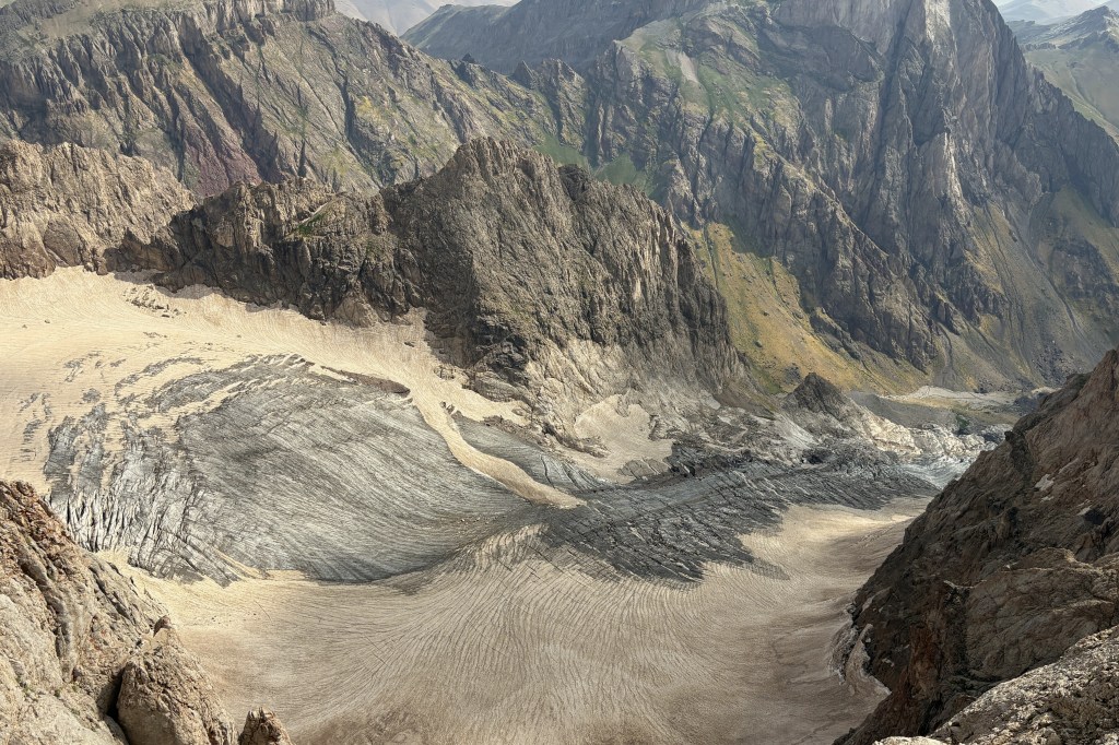
Around 07:00, we reached a wide ridge at the end of our initial ascent — a natural balcony overlooking the vast landscape below. Off to our left, nestled in a mountain basin, we spotted small patches of glacier, quietly sitting there like they’ve done for thousands of years. We figured these were the famous 20,000-year-old Cilo glaciers — not realizing we’d soon come across a much, much larger one further along the trail.
We took a moment to soak it all in, snapped a couple of group photos (as you do), and then kept climbing, following the trail as it wound higher into the mountains.

After carrying on for roughly 30–40 minutes, we finally caught sight of the real Cilo glaciers, sitting deep in the valley while we stood at around 3,900 meters. From up here, their vastness looked even more surreal. We later learned that two people had tragically lost their lives near those glaciers just last year, and just felt lucky to be standing nearly a thousand meters above them.
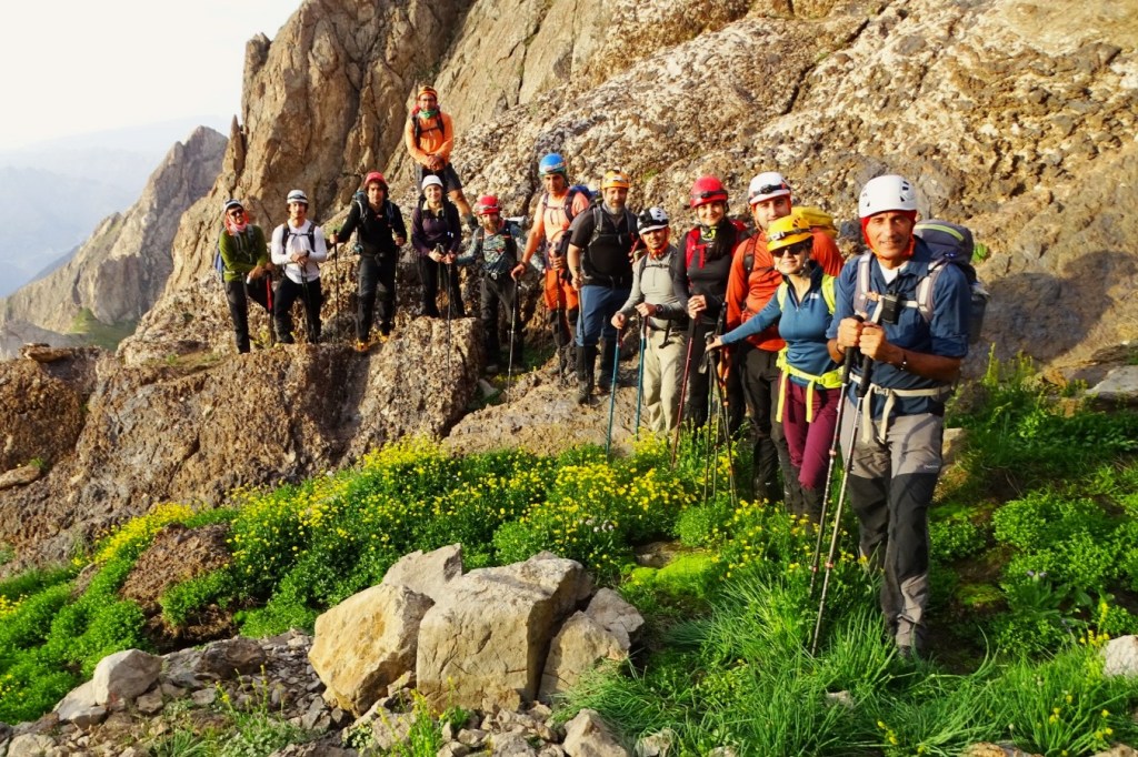
This was also the point where the climb became noticeably more challenging and a bit more technical. We had to ascend a narrow ridge, with a drop of over 1,000 meters right next to us. A few people in our group weren’t exactly thrilled about the idea of hiking along that kind of exposure, so we slowed down and moved with extra caution.
Somewhere along the way, we met a group of four locals from Yüksekova (the ones further up the mountain in the below picture). It was their first time climbing this mountain too — because, like us, they never had access to it before. We chatted about their culture, their village, the food they ate, even their families. But as the altitude started thinning the air and slowing our words, the four of them quietly picked up pace and disappeared ahead of us, leaving us in their dust.
When I first started mountaineering, someone told me that the best climbers they’d ever met were villagers and shepherds — people who’d fly by them up the mountain in slippers or worn-out shoes and no fancy gear. With every passing mountain, I begin to understand what they meant.

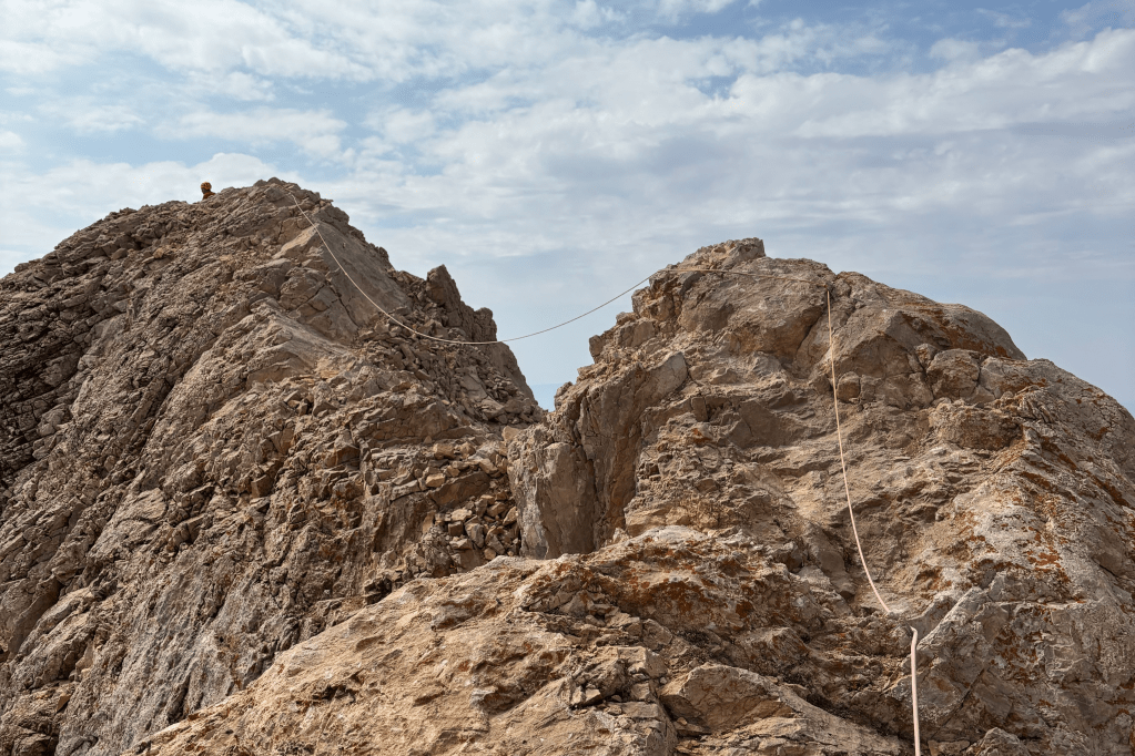
Finally, we reached the most technical and the most feared part of the climb: the infamous knife-edge ridge. Imagine a narrow path barely half a meter wide, with a 1,000 to 1,500 meter drop on either side. One wrong step, and… well, you get the idea.
Luckily, there was already a fixed station set up, so we didn’t need to install one ourselves. With guidance from our group leader, some of us crossed with harnesses and safety lines, while a few brave souls decided to go without. By 09:00, our entire group had made it across safely.
It was my first time crossing a knife-edge ridge — and I’ve got to admit, there’s something strangely addictive about it. It’s just scary enough to spike your adrenaline, but thrilling enough to make you want to do it all over again. Or maybe I’m just a bit of a psychopath. Who knows?
Before coming to Cilo, we had read quite a few activity reports, and almost all of them made it sound like the summit was just a short stroll away after the knife-edge ridge. That really threw us off. Not long after crossing, we ran into our local friends again, the same group of four from Yüksekova, and they warned us that there was still a long way to go. So we didn’t rest much and pushed on.
Turns out, there are still three separate ascents left before reaching the summit. The terrain itself isn’t particularly technical or difficult, but the altitude? That’s the real game-changer. I was one of the lucky ones — it didn’t hit me too hard — but several people in our group started feeling the full effects: pounding headaches, nausea, and exhaustion. At that point, the climb turns into a mental challenge just as much as a physical one. But everyone in our group was locked in, hungry for the summit, so we kept moving.
About 30 minutes after the ridge, we came across a massive crater, with a sheer 1,000-meter drop that looked like something straight out of Game of Thrones — think the moon door where Lysa Arryn gets pushed by Littlefinger (Petyr Baelish). In the summer, it’s easy to spot and avoid, but in winter, it might be different. Deep snow can hide both the crater and its edges, making it genuinely dangerous. So, if you ever come up here during snow season — watch your step.
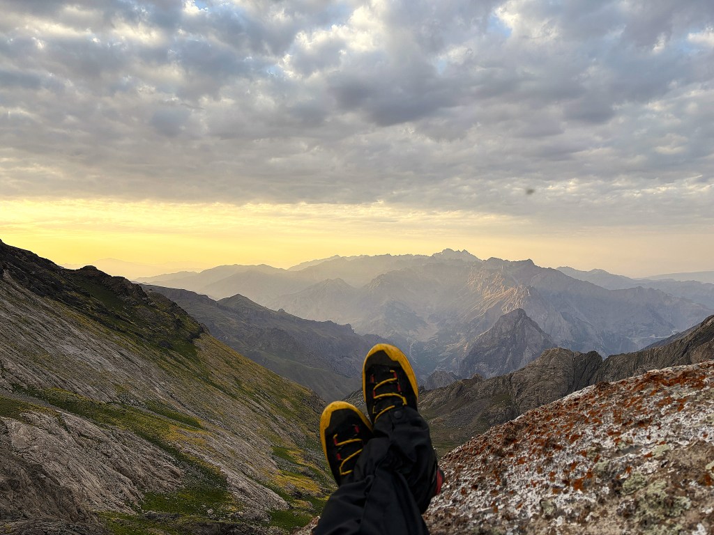
After passing the crater it was only a short walk filled with a bunch of rest stops in between and by 10:07 we reached the summit. It had taken us a little shorter than 6 hours but it was well worth it. Not only being able to summit the second highest mountain is an achievement in and of itself but the limitless views are absolutely breathtaking (both literally and figuratively). We all took our individual and group pictures as ANADAK Anadolu Dağcılık, fueled up and didn’t rush while taking the views in. We lingered around 1 hour to soak it all in although you could hold it much shorter.

At 11:10, we began descending from the summit, retracing the same route we had taken up. Surprisingly, the descent turned out to be more challenging — at least for me and a few others in the group — than the climb itself. We had a last-minute change of plans: since the Turkish Mountaineering Federation (TDF) was scheduled to arrive on the mountain that day, we had to be back at our campsite by 15:00 so the mules could haul our gear down before heading back up with TDF’s equipment.
That meant we had to descend the entire summit route in under four hours, break down camp, pack all our gear, and then tackle another 3–4 hour descent from Horgedim Plateau to the Serpel Plateau where our minivan would be waiting. In total, it came out to nearly 2.000 meters of elevation gain and loss over the course of just 28 hours. That’s a lot, both physically and mentally.
On the way down, my knee started acting up — the same issue I’ve had on descents from Hasan and Dedegöl Mountains. But those routes had snow, which cushioned the impact a bit. This time, it was brutal. Every step down to the campsite was agonizing, and the descent from the plateau to the base was even worse. I’d recommend taking a glucosamine supplement if you’re thinking of doing this expedition. It really helps ease the strain on your joints, especially your knees. And don’t underestimate the value of occasionally sitting down to enjoy the view and give your body a well-earned rest.
We made it back to the campsite around 16:00, quickly packed up our tents and gear, and filled our water bottles one last time before heading out. We said our final goodbyes to our local friends, hugging, sharing a few last laughs, and promising to visit their villages someday. Then we began the long walk down to Serpel Plateau.
We followed the same path as before, this time much slower, worn down by exhaustion. By the time we arrived at the plateau, it was already dark. We turned on our headlamps, found the little bridge we had crossed only a day earlier, and made our way to the waiting minivan.
Once we loaded everything up, we were greeted by one final gesture: a cup of hot traditional tea offered by the shepherd at the base. It was the perfect send-off before our one-hour drive back to the hotel.
Of course, we stopped at Çorbacım again, though this time with way less energy and even emptier bellies. Conversations were quiet — everyone was exchausted — but we still managed to plan a Domino’s order for the hotel, because soup just wasn’t going to cut it.
We checked in, demolished our pizzas, drank what was probably the best Coke of our lives, and finally crashed into bed for what might’ve been the most well-deserved sleep we’ve ever had.
Day 3: Ice-Age Glaciers, Prehistoric Rock Art, and a Wedding with Strangers
I don’t know how, but our third day in Hakkari somehow turned out even cooler than the ones before. We didn’t force ourselves to wake up early, we took our time and enjoyed a proper hotel breakfast. Around 11.00, we hit the road toward the Sat Glacier Lakes but quickly stopped to grab coffee for the ride. What we didn’t know was that this quick coffee break would completely transform our day.
While waiting outside for our coffees, we spontaneously decided to take a memory photo — a bit random, considering we were just standing in front of a simple coffee house. It must’ve looked strange to others too, because two people from the restaurant next door approached us, curious about where we were from. We told them we were visiting from Istanbul, and a conversation quickly sparked. Turns out, they were locals from Yüksekova — and wedding photographers. Naturally, we asked about the wedding culture in Hakkari, since weddings in Eastern Turkey are known for being extravagant and full of life.
They were genuinely happy that we were so curious about their culture and, without hesitation, invited us to the wedding they’d be attending that evening. They even introduced us to the singers who’d be performing that night. Before we left, they gave us the address of the wedding house and we promised to be there. That quick coffee stop had unexpectedly turned into one of the most wholesome encounters of our entire trip.
We continued on our way, and just like the day before, passed through the same military checkpoint. This time, the soldiers were more relaxed — they recognized us and even congratulated us on reaching the summit of Cilo.
When we finally arrived at the Sat Glacier Lakes, we were genuinely amazed. We had seen the photos — and they already looked magical — but nothing could’ve prepared us for the real thing. Nestled at 3.500 meters in the heart of the Cilo Mountains, also known as the “Alps of Yüksekova,” these lakes are surrounded by towering peaks, wildflowers in full bloom, and patches of untouched snow, even in the middle of summer. There’s something raw and otherworldly about this place. It’s not just beautiful — it’s surreal.

We didn’t hesitate, stripped down, and jumped straight into the freezing waters of the lake. Standing waist-deep in that glacial water, taking in the scenery all around us, felt genuinely magical. It made me wonder how many hidden gems like this lie scattered across our country — places we’ve never even heard of. But I didn’t get to sit with that thought for long, because our group was already on the move, eager to explore the second lake just a short walk away.
This one had a waterfall beside it, and as soon as we saw it, we took off running. You can probably picture what a glacier-fed waterfall looks like but standing under one is an entirely different experience. The force of the water makes it a challenge to stay upright, and the cold hits you with a sharpness that’s hard to put into words.

After surviving the waterfall, of course we jumped into the second lake too. Then we sunbathed for 15 to 20 minutes, finally starting to feel our bodies again. That peace didn’t last long though, because we found out there was one final lake about 15 minutes away by car. So we dried off, got dressed, and set off once more.
The drive itself was stunning. The dirt roads snaked through towering peaks, with new views unfolding at every bend. This region felt like a place that could go on forever.

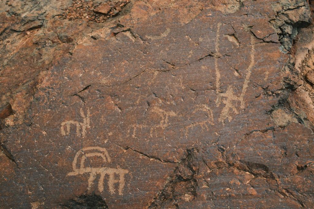
When we reached the last lake, it was just as breathtaking, but this time none of us rushed to get in. We were still recovering from the cold. Instead, our driver mentioned something even more intriguing: ancient rock carvings made by early humans using obsidian, granite, and quartz. As we drove down, a few of us stopped for a quick bathroom break, while the rest couldn’t resist the urge to dance during the short five-minute pause.
A little further along, the driver pulled over and pointed us toward a general area. These carvings weren’t marked on any maps or protected in any way. We explored on foot for a while, and finally, one of us spotted a rock with a goat figure on it and we knew we’d found them.
There they were: prehistoric drawings, quietly resting beside a dirt road, completely unmarked and unprotected. Tens of thousands of years of history, just lying there in plain sight. Most of them date back to the end of the last Ice Age, around 28.000 to 30.000 years ago, and show scenes of hunting, animals, and people.
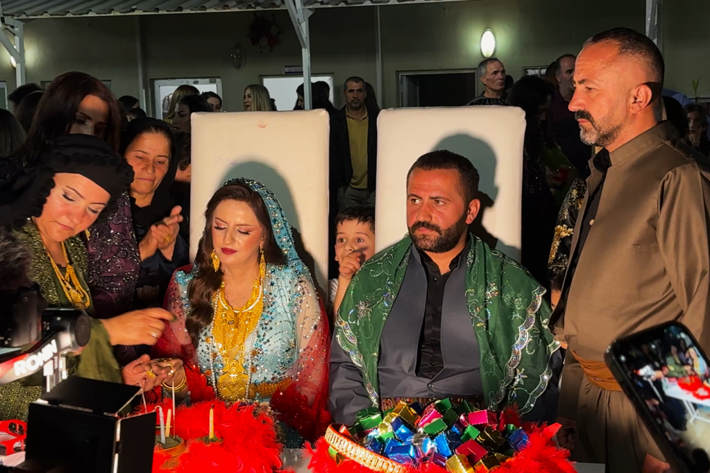
After this quiet and historic moment, we returned to the city center for a generous lunch. We were all pretty exhausted from the day, so once we got back to the hotel, it was a real challenge convincing ourselves and each other to head out to the wedding we had been invited to. But we had given our word, and we had to keep it. So we showered, put on the most suitable clothes we could manage — which was a real challenge, considering we had only packed for a mountaineering expedition — and took two taxis to the wedding.
Our group was eight people, with me leading the charge as the unofficial spokesperson since I was the one who’d talked with the photographers earlier that day. When we arrived, we were met with a huge crowd at the entrance. Even I, up to that point quite confident, started to feel a bit nervous about how we were going to get in. But I reminded myself of all the stories I’d heard about the warmth and hospitality of Eastern Turkey and walked up to the door.
Thankfully, we spotted the singers we had met in the morning, and they were thrilled to see us. They helped us enter, and after congratulating the groom’s side, who were welcoming guests at the door, I gave a short explanation about our outfits, that we had come straight from the mountains and had only been invited that morning. They welcomed us warmly, and we sat down at the first open seats we saw.
At first, it felt like people were staring at us, unsure of why we were there — or so we thought. We later learned that men and women sit on opposite sides of the hall at weddings here, so our mixed seating arrangement might have caused some confusion. Or maybe it was just our very informal outfits at a formal event. But soon enough, people began approaching us with genuine smiles, asking how we were, where we were from, and offering food and drinks. They were truly happy we had come.
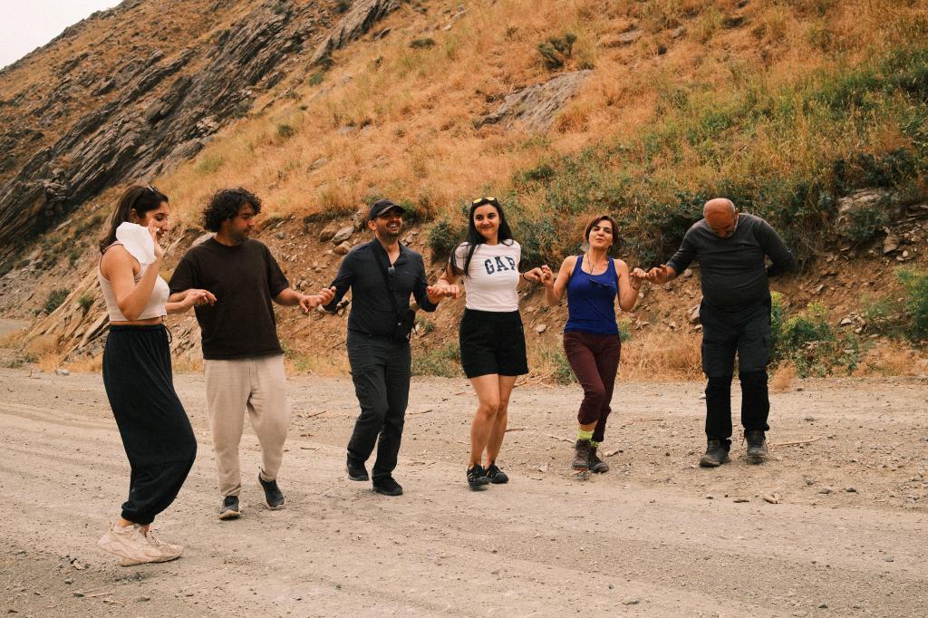
And then we saw Berat — the photographer who had invited us. He spotted us from across the room and instantly made us feel at home. He introduced us to more people, and before long, we were invited to join the Halay, a traditional Anatolian folk dance that’s especially beloved in Eastern Turkey. Most of our group had never tried it before, and a few of us were quite terrible at it, but everyone was so eager to include us and teach us how it’s done.
So, for the next 2–3 hours, we danced like crazy. The music didn’t stop, the energy only grew, and we were totally swept up in it all. I have a few videos of myself dancing, but I genuinely hope they never see the light of day. Instead, here are the real pros in action.

It was hands down one of the most fun nights I’ve ever had. And to feel so included and welcomed in a region of Turkey that many people view with fear or prejudice was powerful. So many men and women came over to share their culture with us, and we left with a completely different understanding of a part of our own country that we had barely known before.
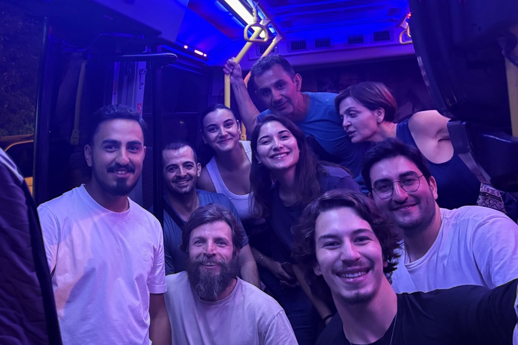
And just when we thought the night couldn’t get any more heartwarming, Berat insisted that we did not leave in the taxis we came in. Instead, he called one of his cousins — who turned out to be a minibus driver — and woke him up just to take us back to the hotel. The ride itself was a whole experience. The inside of the minivan looked more like a nightclub than a vehicle, with flashing lights and Halay music still playing, keeping the celebration alive a little longer.
Sadly, this was our last full day in Yüksekova. The next morning, after a final breakfast at the hotel, we headed to the airport for our 11:15 flight back to Istanbul and returned home.
Before I wrap up this Reşko-Cilo blog, I just want to leave you with a few closing thoughts.
Some Closing Thoughts and Thanks
Nothing great in life comes from sitting still. As the beloved Anthony Bourdain once said: “If I’m an advocate for anything, it’s to move. As far as you can, as much as you can. Across the ocean, or simply across the river. The extent to which you can walk in someone else’s shoes or at least eat their food, it’s a plus for everybody. Open your mind, get up off the couch, move.”
This entire trip; the mountain, the people, the wedding might sound a little crazy when you read about it. Honestly, it would’ve sounded crazy to me just two years ago, before I ever started this whole mountaineering journey. But this is exactly how life is supposed to be: an exploration.
Staying the same and never stepping out of your comfort zone should not be an option. The amount you grow is directly proportional to how much you go out there and explore. The addictive pull of social media and endless content makes it harder than ever to leave our rooms but that’s not how life is meant to be lived.
It’s not even about the place you’re going, it’s about the simple act of going. Of moving. Of discovering. And it’s even better when you get to share that experience with people you love.
So here’s to my group, who made this entire journey possible and unforgettable. And to everyone I met along the way, in a place I never imagined being welcomed and embraced so openly, thank you for everything.


Leave a comment